|
(c) copyright 2008 by Knowledge College & Stephan Berndt |
|
Further Functions |
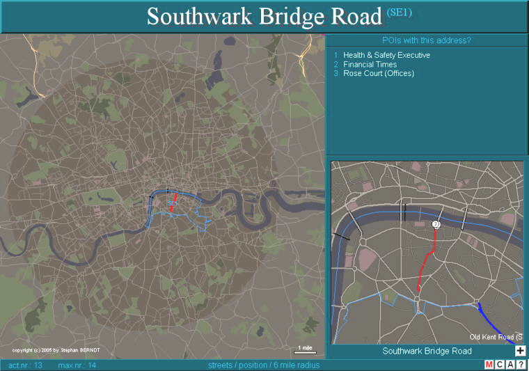
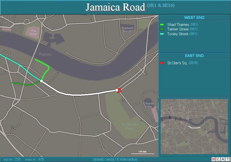
Streets & Places A taxi driver needs to know where the streets and places are, and in which area (postcode area or district). At this level you have to think over, where the street on top is in the map. After the first button is pressed just the postcode area(s) appear (s), that the street is in. After the next button is pressed the program is drawing the street into the big map and at the same time the small right map appears, showing the surrounding of the street (or place). In case the street (or place) is the address of points of interest this gets mentioned too. |
|
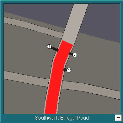
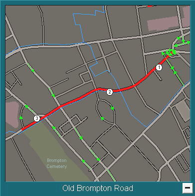
Streets & Places As you can see on the image above few points of interest are listed and drawn in the small map on the right. But what you see is a little unclear, so click on [ + ] on the right bottom and the map will zoom in. Now you can see where and on which side of the street the exact the points of interest are, having the upper address. (Southwark Bridge Rd) The second image is another zoom in map of a surrounding, showing one ways (small green arrows). |
|
|
||
|
|
|
|
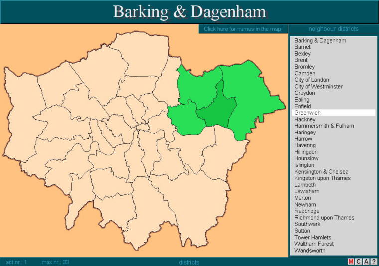
Districts Districts usually don't play a particular role in the Knowledge. But we think, it is good to know a little about the districts position, because you will find the districts name in a lot of streets, places and points of interest.
|
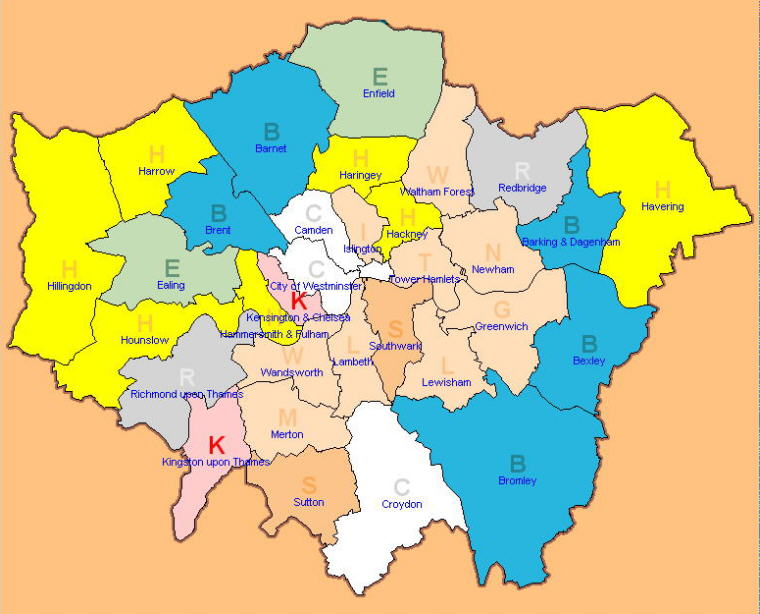
This is a help at the level "districts". We thought: same first letter = same colour ... would be a good help. So H, B, E, S, C, K and R got an own colour. |
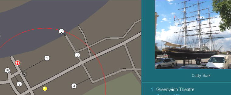
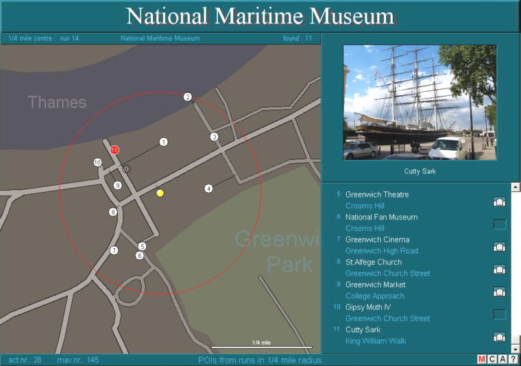
points in 1/4mile radius This is another way of learning points of interest. According to start and goal of the I.80 runs this is about the points of interest in the 1/4 mile radius of start and goal (or along the run). The points of interest found in the 1/4mile radius (or along the run) get listed (plus address) on the right side, and the position is marked on the map. If there is a photo it is shown. If you like you can scroll on the very right. Click on the house symbol, and you see an image of the point. (not here - in the program)
|
|
|
|
photo / point of view If there is a photo, you can see the position from which the photo is taken in many cases. Like here: Ca. 1 cm under and a little to the right the white 11 you can see a fine black circle with a black dot in it's middle. This is the point of view for the photo from Cutty Sark. Not so much interesting in this case. But there are cases, where it is good to know, from where the photo was taken. |